Introduction to Urban Radar
Urban Radar is a project that helps cities and businesses manage mobility and logistics in a sustainable way. It uses data to make better decisions. This is important because cities are growing fast, and we need to take care of our planet. Urban Radar is here to help with that. By analyzing data, cities can understand their needs better and make smart choices. This article will explore how Urban Radar works and its benefits for cities and businesses.
Benefits of Urban Radar
- Data-driven insights for better decision-making.
- Improves operational and environmental performance.
- Helps cities meet climate goals.
- Enhances local economy through better logistics.
- Easy-to-use tools for data visualization.
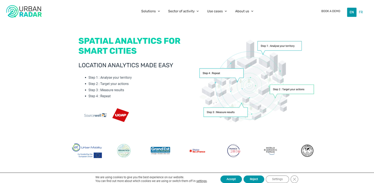
Step 1: Analyze Your Territory
The first step in Urban Radar’s process is to analyze the territory. This means looking at all the data about a city or area. Cities generate a lot of information, like traffic patterns, air quality, and land use. By collecting and analyzing this data, Urban Radar helps city planners see what is happening in their areas. This is important because it allows them to make informed decisions. For example, if a city sees that traffic is heavy in a certain area, they can plan to improve public transport or create bike lanes.
Step 2: Target Your Actions
After analyzing the territory, the next step is to target actions. Urban Radar provides insights that help cities and businesses focus on what matters most. This means they can prioritize their efforts based on the data. For instance, if a city finds out that certain neighborhoods lack access to public services, they can direct resources there. This targeted approach ensures that actions taken are effective and meet the needs of the community.
Data Visualization Made Easy
One of the best things about Urban Radar is its user-friendly data visualization tools. You don’t need to be a tech expert to use them. The platform allows users to drag and drop data, making it easy to see trends and patterns. This is crucial for city planners and businesses alike. They can quickly understand complex data and share it with others. This helps everyone involved to make better decisions based on clear information.
Strengthening Local Economies
Urban Radar also plays a big role in strengthening local economies. By improving logistics and mobility, cities can enhance their economic performance. For example, better curb management can reduce congestion and improve delivery times. This is good for businesses because it means they can serve their customers better. Additionally, by following policy indicators, cities can measure the impact of their actions and make real-time adjustments. This ensures that they are always moving towards their climate goals.
Client Testimonials
Urban Radar has received positive feedback from clients in various cities. For instance, the city of Barcelona has praised the platform for addressing logistics and street management challenges. Clients have noted how intuitive and modular the technology is. They appreciate the ability to share analyses with elected officials and road network management. This collaboration is vital for making informed decisions that benefit the community.
Link to Sustainable Development Goals
- Goal 11: Sustainable Cities and Communities
- Goal 9: Industry, Innovation, and Infrastructure
- Goal 13: Climate Action
- Goal 8: Decent Work and Economic Growth
- Goal 3: Good Health and Well-being
Conclusion
Urban Radar is committed to helping cities become more sustainable. By using data to inform decisions, they contribute to a better future for everyone. If you want to learn more about Urban Radar and how it can help your city, visit Urban Radar’s website.